Your maps. Your infrastructure. No internet required.
Deploy vector maps and routing entirely inside your environment—for secure, disconnected and mission-critical operations.
- Vector tiles
- Routing
- Custom styles
Mapping should not depend on external connectivity.
Many mapping platforms assume continuous access to an external cloud service. That assumption breaks down inside restricted networks, remote locations and operational environments where availability and control cannot depend on a public connection.
SenDevo Offline Map Server brings the map service, routing engine and geographic data into the customer’s own infrastructure, keeping essential location services available where they are needed.
Restricted networks
Operate map-enabled applications inside private or air-gapped environments where outbound connectivity is limited or unavailable.
Unreliable connectivity
Keep essential mapping and routing services available when internet access is intermittent, costly or operationally unsuitable.
Infrastructure control
Run the platform under your own access policies, network controls and operational procedures.
Predictable availability
Serve internal applications from infrastructure managed within your own environment rather than relying on a remote map provider for every request.
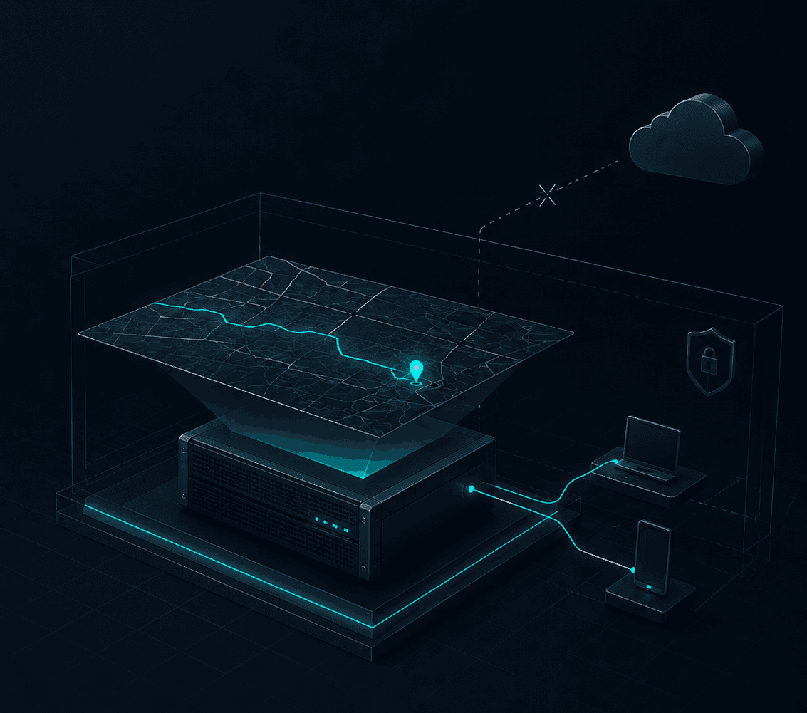
A complete geospatial backend inside your environment.
The deployment combines a prepared geographic data package with runtime services inside one customer-controlled boundary. Internal applications consume local endpoints; package preparation and updates remain separate delivery activities.
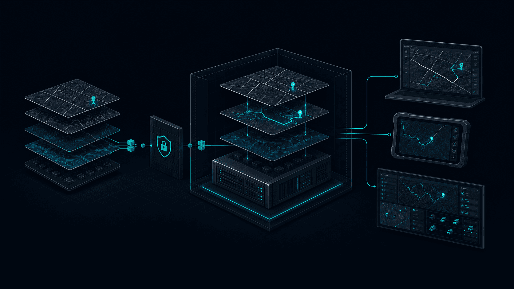
LOCAL MAP PLATFORM
Everything required to operate maps locally.
From map rendering to route calculation, essential geospatial services run together as one deployable platform inside your environment.
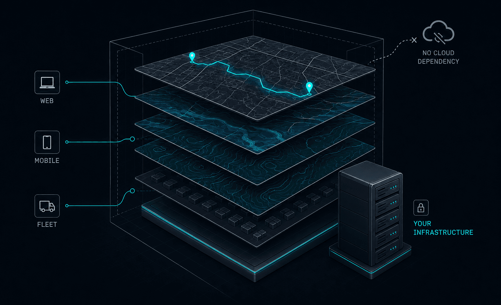
Serve maps from your own infrastructure
From geographic scope to operational service.
Every deployment is prepared around the required coverage, target infrastructure and application environment. SenDevo works with the customer to define the package, deploy the platform and connect the required systems.
Define the operating scope
Confirm the required countries or regions, routing needs, map styles, target applications and expected deployment environment.
Prepare the platform package
Configure the geographic data, map services, routing capability and styles included in the agreed solution.
Deploy inside your infrastructure
Install the platform in the approved on-premises, private-network or disconnected server environment.
Connect your applications
Integrate web, mobile, fleet or operational applications with the local map and routing endpoints.
Validate and operate
Verify coverage, styles, routing and application behavior before the platform moves into operational use.
Maps designed for the way your teams work.
Different operational environments require different visual priorities. SenDevo Offline Map Server can deliver map styles suited to daylight use, dark control-room interfaces and project-specific presentation requirements.
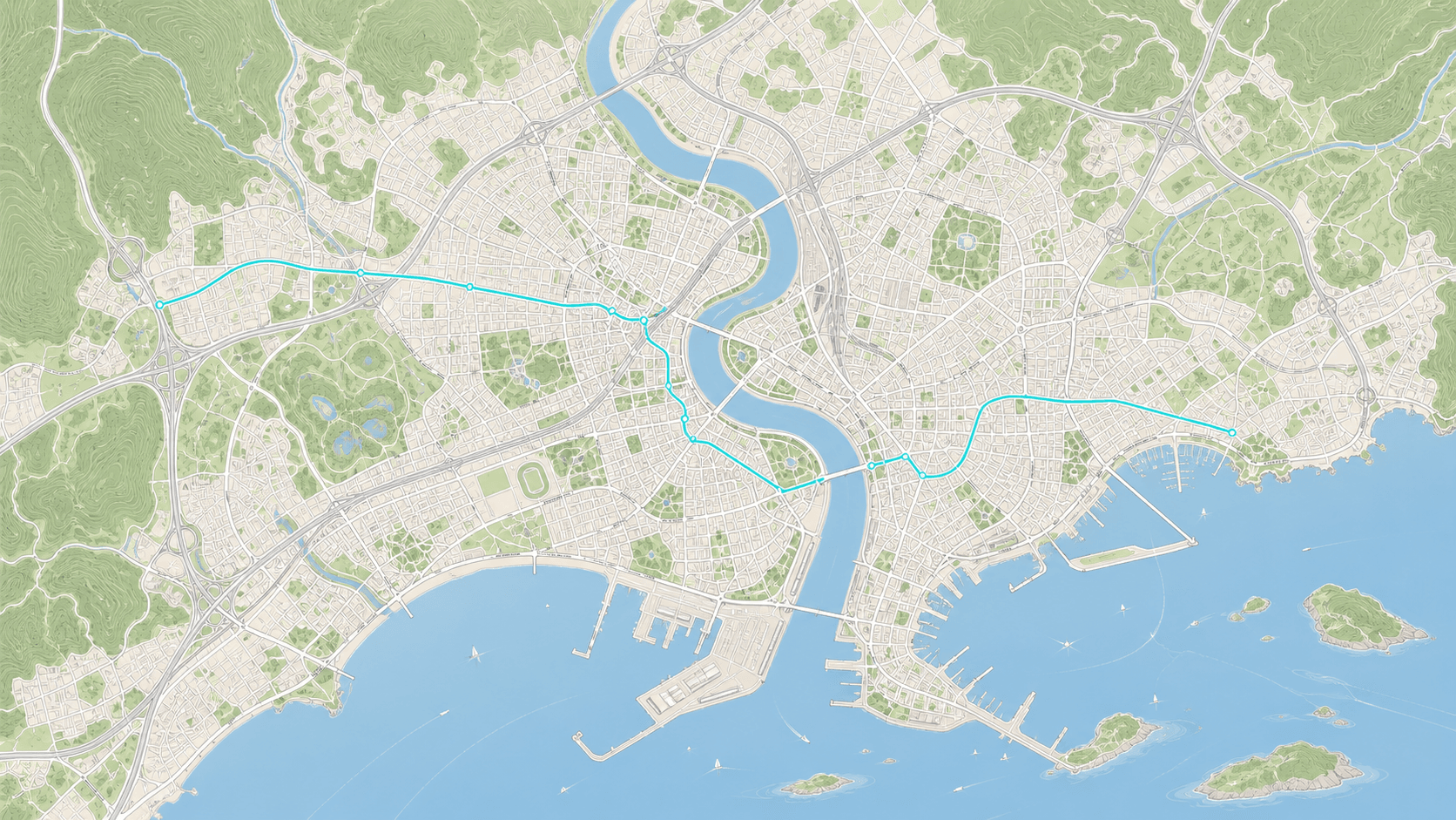 LIGHTDARK
Reduced visual glare and stronger contrast for control rooms, monitoring interfaces and dark application themes.
One map platform for every connected application.
Provide a consistent map and routing service across internal applications while keeping deployment and geographic data centrally managed inside the customer environment.

Deliver interactive maps and routing to browser-based operational systems and enterprise portals.
Built for environments where mapping must remain available.
Provide map-enabled services inside controlled government infrastructure where external connectivity, data handling and system access are governed by internal policy.
Deploy the geography your operation requires.
Geographic coverage is prepared according to the countries, regions or operational boundaries included in the project scope. This keeps deployment focused on the areas the customer actually needs.
Coverage can be packaged for a single country, a regional group or a defined operational area, subject to data availability, licensing and the agreed product configuration.
Discuss your coverage requirementsDefine
Specify the countries, regions or operational boundary required.
Review
Confirm source-data availability, licensing and routing requirements.
Prepare
Package the agreed geographic data for the target deployment.
Keep map operations within your infrastructure boundary.
The platform fits behind the controls an organization already operates instead of replacing them. Teams determine network placement, access policy and the procedures used to administer the service.
Local request processing
Map and routing requests terminate at services placed inside the approved network boundary.
Customer-controlled access
Existing network, authentication and authorization controls remain under the organization's administration.
Operational separation
Normal map use is separated from public map APIs; installation, licensing and update arrangements are defined for each deployment.
A deployment model built for long-term operation.
SenDevo Offline Map Server is delivered according to the required geographic coverage, routing scope, infrastructure environment and support arrangement. The applicable licence term and usage rights are stated in the written quotation and agreement.
Platform license
The right to deploy and operate the agreed SenDevo Offline Map Server configuration under the applicable commercial terms.
Geographic package
Prepared map data for the countries, regions or operational areas included in the project scope.
Routing capability
Local route calculation for the agreed geographic coverage when included in the selected package.
Map styles
Light, dark or agreed project-specific map styles included in the delivery scope.
Deployment support
Technical assistance for installation, configuration and initial integration according to the agreed statement of work.
The final delivery scope records the licensed configuration, included data and services, deployment assistance and any separately agreed support or update arrangement.
Review quotation factorsPricing built around your deployment not your traffic.
Each quotation reflects the geographic coverage, services, deployment topology, integrations, configuration and support arrangement required for the operating environment.
Geographic coverage
Countries, regions or operational boundaries that must be prepared for the deployment.
Included services
Vector map delivery, routing, style delivery and any agreed supporting services.
Deployment topology
Single-server, redundant, restricted-network or air-gapped infrastructure requirements.
Application integrations
The web, mobile, fleet, IoT or control-room systems that will consume the platform.
Styling and configuration
Standard map styles or project-specific visual, labeling and configuration requirements.
Support and updates
Deployment assistance, platform support, data updates and any agreed service arrangement.
SCOPED QUOTATION
Get a quotation matched to your environment.
Share the target region, intended applications and deployment requirements. SenDevo will define the appropriate technical and commercial scope.
Request a scoped quotationFrequently asked questions
Once deployed with the agreed geographic data and services, the platform can deliver maps and routing inside the customer environment without relying on a public internet connection for normal operation. The exact installation, licensing and update process is defined for each deployment.
The platform is designed for customer-controlled server environments, including on-premises infrastructure, private networks and disconnected environments. Final infrastructure requirements depend on coverage, workload and integration scope.
Yes. Supported applications can connect to the locally deployed map, style and routing services. Integration requirements are reviewed against the application technology and target environment.
Update methods depend on the customer's network restrictions, operational procedures and support arrangement. SenDevo can define an appropriate package and update process as part of the deployment scope.
The licence term, permitted deployment and usage rights are stated in the written quotation and agreement for the selected configuration.
Infrastructure requirements depend on geographic coverage, expected request volume, routing usage, availability requirements and deployment architecture. SenDevo reviews these factors before recommending a configuration.
SenDevo prepares a scoped quotation after confirming the required operating environment and delivery scope. This keeps commercial terms tied to the deployment being delivered rather than public-map traffic volumes.
Bring reliable mapping into your own environment.
Tell us where the platform will operate, which applications it needs to support and what geographic coverage you require. SenDevo will help define the right offline map and routing package for your environment.
Provide your target region, deployment environment and intended use case so we can prepare a relevant discussion.